Watershed Protection
William Penn Foundation’s Delaware Watershed Protection Program: GIS Mapping and Analysis Report – January 2014
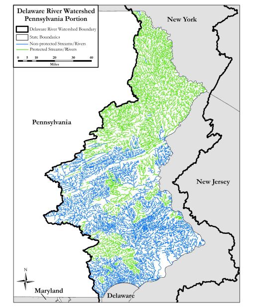
This report investigated the role and relative importance of two different riparian buffer rules adjacent to streams/rivers in the Delaware River Watershed. The Delaware River Watershed encompasses 8,717,648 acres across five states (Delaware, Maryland, New Jersey, New York, Pennsylvania). The following sections highlight the results of a series of analyses aimed at answering seven research questions:
1. What are the total and currently protected stream/river miles in the Delaware River Watershed?
2. What is the potential riparian corridor area of the currently non-protected streams/rivers, at two buffer distances: 150’ and 300’?
3. What is the area of currently protected land within each of the two buffer distances?
4. What is the total forest area within currently protected and non-protected lands within each of the two buffer distances? (State-level analysis)
5. What is the total agricultural area within currently protected and non-protected lands within each of the two buffer distances? (State-level analysis)
6. What is the total built area within currently protected and non-protected lands within each of the two buffer distances? (State-level analysis)
7. What is the total forest area within currently protected and non-protected lands within each of the two buffer distances? (County-level analysis)
The Appendix section of this report provides details on specific datasets, queries, GIS operations, and the overall workflow used to answer each research question
Published: January 2014
Download Report